|
|
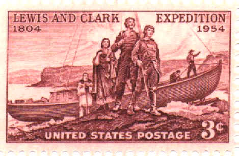
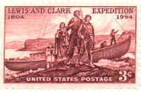
A
3-cent stamp issued in 1954 depicting Meriwether Lewis, William Clark
and Sacagawea landing on a Missouri River bank. These surveyors
and explorers were instrumental in opening up the western lands of the
United States with their journey of exploration and mapping from 1804 to
1806. |
|

|
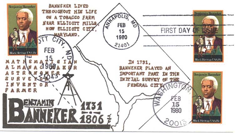
A 15-cent stamp
issued in 1980 to honor and commemorate the life of Benjamin
Banneker. Said to be the "first black man of science",
his many duties included assisting Andrew Ellicott in surveying the
"new" federal city of Washington, D. C. in the early 1790's. |
|
|
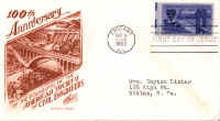
A
3-cent stamp issued in 1952 showing the George Washington Bridge and an
1850's covered bridge to honor the 100th anniversary of the American
Society of Engineers, many of whose members were surveyors. |
|
|
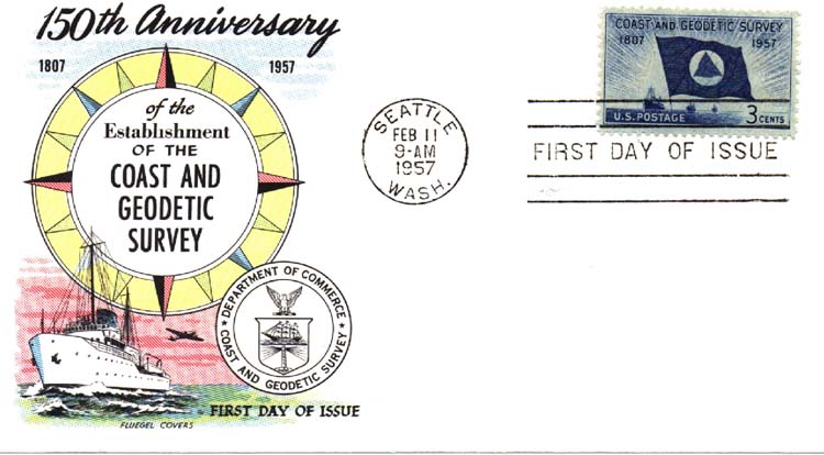
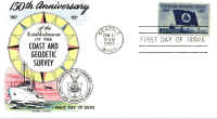
A 3-cent stamp
issued in 1957 showing the flag of the Coast & Geodetic Survey and
ships at sea. This stamp honors the 150th anniversary of this
group whose surveying efforts were instrumental in the development of
this country. |
|

|
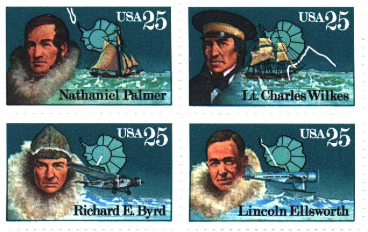
A
series of 25-cent stamps issued in 1988 to commemorate these explorers
and mappers: Nathaniel Palmer, Lt. Charles Wilkes, Richard E. Byrd
and Lincoln Ellsworth. Their efforts gave us a better
understanding of the world. |
|
|
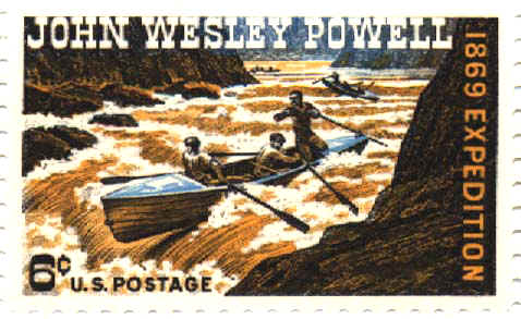
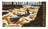
A 5-cent stamp
issued in 1969 to honor John Wesley Powell whose efforts at surveying
and mapping helped the United States to understand what our western
lands consisted of. |
|
|
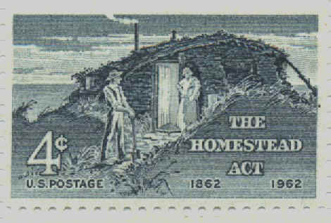
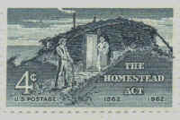
A
4-cent stamp issued in 1962 on the 100th anniversary of the Homestead
Act. Homesteading in the western United States could not have
succeeded without the efforts of surveyors who laid out the land into
sections prior to the arrival of settlers. |
|
|
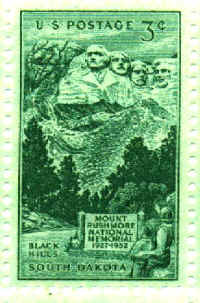
A 3-cent stamp
issued in 1952 to commemorate the 25th anniversary of the Mt. Rushmore
National Memorial. Captured in the memorial are the images of
"three surveyors and another guy". Presidents
Washington, Jefferson and Lincoln all performed surveying during their
lives. |
|
|
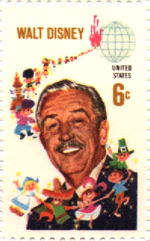
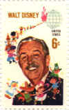
A
6-cent stamp issued in 1968 to commemorate the lifelong efforts of Walt
Disney. One of Mr. Disney's first jobs was that of a draftsman for
Major Thomas Cox, Jr., and J. R. Reagan in Asheville, North Carolina.
While employed by these men, he prepared several subdivision plats that
can be found in the county records. |
|
|
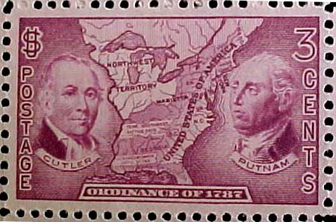
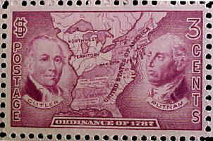
A
3-cent stamp issued in 1937 to celebrate the 150th anniversary of the
Northwest Ordinance of 1787. Through this measure Ohio became the
experimental site of the new public land surveying and sale system.
A number of different surveying systems were employed. The
mistakes that were made and the lessons learned culminated in the Land
Ordinance of 1796, which laid out the surveying and numbering scheme
used for all remaining public lands. |
|
|
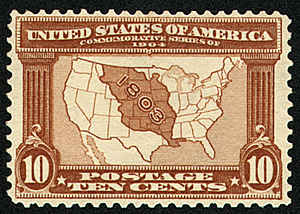
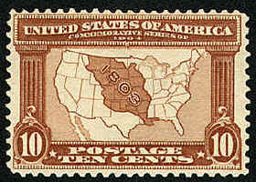
A
10-cent stamp issued in conjunction with the 1904 World's Fair - The
Louisiana Purchase Exposition in St. Louis, Missouri. The
Louisiana Purchase has been described as the greatest real estate deal
in history. In 1803 the United States paid France $15 million for
the Louisiana Territory--828,000 square miles of land west of the
Mississippi River. The lands acquired stretched from the
Mississippi River to the Rocky Mountains and from the Gulf of Mexico to
the Canadian border. The Louisiana Purchase nearly doubled the
size of the United States, making it one of the largest nations in the
world. |
|
|
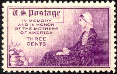
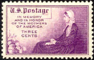
A
3-cent stamp issued in 1934 to commemorate Mother's Day. It is an
adaptation of James McNeill Whistler's portrait of his mother, entitled
"Arrangement in Gray and Black." Known for his wit and
eccentricity, Whistler was one of the most influential painters and
etchers in the 19th century art world. Ironically, he learned the
art of etching while working for the cartographic section of an
organization with little use for artistic license: the U.S. Coast
and Geodetic Survey. |
|

|
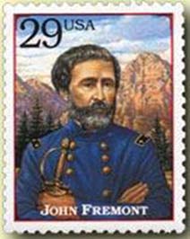
A
29-cent stamp, one of a set of 20 different subjects on the 1994
"Legends of the West" sheet of stamps. "The
Pathfinder", John Charles Fremont was one of California's first
senators, the first presidential candidate of the Republican Party (he
lost to James Buchanan in 1856), an officer in the Union Army during the
Civil War and Governor of the Arizona Territory. Early in his
career, Fremont surveyed the Carolina Mountains as an officer in the
Army Topographical Corps but he is best remembered for the expeditions
he led during the 1840s and early 1850s to explore, survey, and map
parts of the Western United States. |
|
|
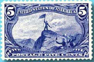
A
5-cent stamp, one of a set of nine issued in 1898 to mark the
Trans-Mississippi Exposition, held that year in Omaha, Nebraska.
Features a scene of John Charles Fremont on the Rocky Mountains. |
|

|
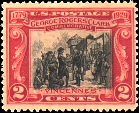
A
2-cent stamp issued in 1929 to commemorate the 150th Anniversary of
George Rogers Clark's victory over the British at Fort Sackville (now
Vincennes), Indiana. George Rogers Clark was born near Monticello,
Virginia in 1752. He was apprenticed as a surveyor and by the age
of 22 was surveying land and farming along the Ohio River in the
Kentucky country, then part of Virginia. At the outset of the
American Revolution, he was commander of the Kentucky Militia. He
took the offensive with a small force and conducted an epic campaign,
which involved incredible overland marches and the capture of several
British outposts, climaxing in the "Night of the Long Knives"
at Fort Sackville on February 25, 1779. This victory effectively
secured the Old Northwest Territory for the United States. Later,
Clark supervised land allotments in the new territory. |
|
|
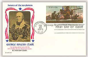
A
10-cent postal card issued in 1979 to commemorate the 200th Anniversary
of George Rogers Clark's victory over the British at Fort Sackville. |